Showing posts with label Wonders of Asia. Show all posts

Tuesday, 24 April 2012

SYRIAN DESERT

SYRIAN DESERT


The Syrian Desert (Arabic: بادية الشام, bādiyat ash-shām‎), also known as the Syro-Arabian desert is a combination of steppe and true desert that is located in the northern Arabian Peninsula covering 200,000 square miles (over 500,000 square kilometers). The desert is very rocky and flat
The Syrian desert is part of the Al-Hamad,which covers portions of Syria, Iraq, Jordan,and Saudi Arabia. Its border on the west is the Orontes Valley, and its border on the east is the Euphrates. In the north, the desert gives way to the more fertile areas of grass. In the south, it runs into the deserts of the southern Arabian Peninsula. Many mini-deserts exist in the Syrian Desert such as Palmyra. Damascus is located on an oasis. The desert's remarkable landscape was formed by lava flows from the volcanic region of the Jebel Druze in southern Syria. The Syrian Desert is the origin of the Syrian hamster.
The desert was historically inhabited by bedouin tribes, and many tribes still remain in the region, their members living mainly in towns and settlements built near oases. Some bedouin still maintain their traditional way of life in the desert. Safaitic inscriptions, proto-Arabic texts written by literate bedouin, are found throughout the Syrian Desert. These date approximately from the 1st century B.C. to the 4th century A.D.

Wednesday, 18 April 2012

Dasht-i-Lut

Dasht-i-Lut

Dasht-e Lut, also spelled Dasht-i-Lut and known as the Lut Desert, is a large salt desert in southeastern Iran and is the world's 25th largest desert. It has been ranked the hottest place on earth at nearly 70.7 degrees C (159-160 degrees F), and is one of the world's driest places.

Iran is climatically part of the Afro-Asian belt of deserts that stretch from the Cape Verde islands off West Africa all the way to Mongolia near Beijing, China. The patchy, elongated, light-colored feature in the foreground (parallel to the mountain range) is the northernmost of the Dasht dry lakes that stretch southward 300 kilometers (190 mi). In near-tropical deserts, elevated areas capture most precipitation. As a result an abiotic zone.
Iran's geography consists of a plateau surrounded by mountains and divided into drainage basins. Dasht-e Lut is one of the largest of these desert basins, 480 kilometers (300 mi) long and 320 kilometers (200 mi) wide, and is considered to be one of the driest places on Earth.
Area of the desert is about 51,800 square kilometers (20,000 mi²).The other large basin is the Dasht-e Kavir. During the spring wet season, water briefly flows down from the Kerman mountains, but it soon dries up, leaving behind only rocks, sand, and salt.
The eastern part of Dasht-e Lut is a low plateau covered with salt flats. In contrast, the center has been sculpted by the wind into a series of parallel ridges and furrows, extending over 150 km (93 mi) and reaching 75 m (250 ft) in height. This area is also riddled with ravines and sinkholes. The southeast is a vast expanse of sand, like a Saharan erg, with dunes 300 m (1000 ft) high, among the tallest in the world.

Dasht-e Kavir


Dasht-e Kavir


Dasht-e Kavir (دشت كوير in Persian), also known as Kavir-e Namak or Great Salt Desert is a large desert lying in the middle of the Iranian plateau. It is about 800 kilometers (497 mi) long and 320 kilometers (198 mi) wide with a total surface area of about 77,600 square kilometers (~30,000 mi²), making it the Earth's 23rd largest desert.The area of this desert stretches from the Alborz mountain range in the north-west to the Dasht-e Lut ("Emptiness Desert") in the south-east and is partitioned between the Iranian provinces of Khorasan, Semnan, Tehran, Isfahan and Yazd. It is named after the salt marshes (kavirs) located there.

The Dasht-e Kavir's climate is almost rainless and the area is very arid. Temperatures can reach 50 °C in summer, and the average temperature in January is 22 °C. Day and night temperatures during a year can differ up to 70 °C. Rain usually falls in winter.
The desert soil is covered with sand and pebbles; there are marshes, lakes and wadis. The hot temperatures cause extreme vaporization, which leaves the marshes and mud grounds with large crusts of salt. Heavy storms frequently occur and they can cause sand hills reaching up to 40 m in height. Some parts of Dasht- e Kavir have a more steppe-like appearance.

MOUNT SINAI

MOUNT SINAI
Mount Sinai (Hebrew: הר סיני‎ Har Sinai) (Arabic: طور سيناء‎ Ṭūr Sīnā’; or جبل موسى Jabal Mūsá, Egyptian Arabic Gabal Musa, lit. "Moses' Mountain" or "Mount Moses"), also known as Mount Horeb, is a mountain in the Sinai Peninsula of Egypt that is the traditional and most accepted identification of the Biblical Mount Sinai. The latter is mentioned many times in the Book of Exodus in the Torah and the Bible as well as the Quran. According to Jewish, Christian and Islamic tradition, the biblical Mount Sinai was the place where Moses received the Ten Commandments.

Mount Sinai is a 2,285-metre (7,497 ft) high mountain near Saint Catherine in the Sinai region. It is next to Mount St. Catherine (at 2,629 m/8,625 ft, the highest peak on the Sinai peninsula and of Egypt). It is surrounded on all sides by higher peaks of the mountain range.

Mount Sinai's rocks were formed in the late stage of the Arabian-Nubian Shield's (ANS) evolution. Mount Sinai displays a ring complex that consists of alkaline granites intruded into diverse rock types, including volcanics. The granites range in composition from syenogranite to alkali feldspar granite. The volcanic rocks are alkaline to peralkaline and they are represented by subaerial flows and eruptions and subvolcanic porphyry. Generally, the nature of the exposed rocks in Mount Sinai indicates that they originated from different depths.

IZMIR

IZMIR
Izmir (Turkish: İzmir) is a large metropolis in the western extremity of Anatolia. The metropolitan area in the entire Izmir Province had a population of 3.95 million as of 2010, making the city third most populous in Turkey. Izmir metropolitan area extends along the outlying waters of the Gulf of İzmir and inland to the north across Gediz River's delta, to the east along an alluvial plain created by several small streams and to a slightly more rugged terrain in the south. The ancient city was known as Smyrna, and the city was generally referred to as Smyrna in English, until the Turkish Postal Services Law of 1930 made "Izmir" the internationally recognized name.
The city of Izmir is composed of several metropolitan districts. Of these, Konak district corresponds to historical Izmir, this district's area having constituted the "Izmir Municipality" (Turkish: İzmir Belediyesi) area until 1984, Konak until then having been a name for a central neighborhood around Konak Square, still the core of the city. With the constitution of the "Greater Izmir Metropolitan Municipality" (Turkish: İzmir Büyükşehir Belediyesi), the city of Izmir became a compound bringing together initially nine, and since recently eleven metropolitan districts, namely Balçova, Bayraklı, Bornova, Buca, Çiğli, Gaziemir, Güzelbahçe, Karabağlar, Karşıyaka, Konak and Narlıdere. Almost each of these settlements are former district centers or neighborhoods which stood on their own and with their own distinct features and temperament. In an ongoing processus, the Mayor of Izmir was also vested with authority over the areas of additional districts reaching from Aliağa in the north to Selçuk in the south, bringing the number of districts to be considered as being part of Izmir to twenty-one under the new arrangements, two of these having been administratively included in Izmir only partially.

HADHRAMAWT

 HADHRAMAWT

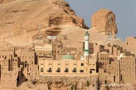
Hadhramaut, Hadhramout, Hadramawt or Ḥaḍramūt (Arabic: حضرموت‎ Ḥaḍramawt) is the formerly independent Qu'aiti state and sultanate encompassing a historical region of the south Arabian Peninsula along the Gulf of Aden in the Arabian Sea, extending eastwards from Yemen to the borders of the Dhofar region of Oman. The name of the region is currently retained in the smaller Hadhramaut Governorate of the Republic of Yemen. The people of Hadhramaut are called Hadhramis and speak Hadhrami Arabic

The origin of the name is not exactly known. There are various theories. One theory is that the region is named after a nickname of Amar bin Qahtan (عمرو بن قحطان), meaning "death has come", from /ḥaḍara/ (Arabic for "has come") and /maut/ ("death"), the reason being that whenever he entered a battle, there were always many people who died.Another theory is that after the destruction of Thamud, the Islamic prophet Saleh relocated himself and about 4,000 of his followers to the area known as Hadhramaut and it was here where he died and thus, the region was called "death has come".


Al Nafud Desert


An Nafud or Al-Nefud or The Nefud (Arabic,صحراء النفود, ṣahrā' al-nefud) is a desert in the northern part of the Arabian Peninsula at
 WikiMiniAtlas
28°18′N 41°00′E / 28.30°N 41.00°E / 28.30; 41.00, occupying a great oval depression. It is 180 miles (290 km) long and 140 miles (225 km) wide, with an area of 40,000 square miles (103,600 km²).
The Nafud is an erg, noted for its sudden violent winds, which account for the large crescent-shaped dunes. The sand in the Nafud is a brick reddish color. Rain comes once or twice a year. In some lowland areas, namely those near the Hejaz Mountains, there are oases where dates, vegetables, barley, and fruits are raised. The Nefud is connected to the Rub' al Khali by the Dahna, a corridor of gravel plains and sand dunes, 800 miles (1,287 km) long and 15 to 50 miles (24.1-80.5 km) wide.
Before the Battle of Aqaba (during the Arab Revolt) forces led by Auda ibu Tayi attacked the Turkish-held coastal town of Aqaba on its poorly-defended eastern flank, achieved by taking a long and wide desert route, passing close to the edge of the Nafud. Col. T. E. Lawrence asked Auda ibu Tayi to allow their group to stray from their course into the Nafud. Auda refused, because it was unnecessary. Their harsh transit did not include entering the Nafud, as is depicted in the film Lawrence of Arabia.

euphrates river


The Euphrates (/juːˈfreɪtiːz/; Arabic: الفرات‎: al-Furāt, Hebrew: פרת‎: Prat, Turkish: Fırat, Kurdish: Firat) is the longest and one of the most historically important rivers of Western Asia. Together with the Tigris, it is one of the two defining rivers of Mesopotamia. Originating in eastern Turkey, the Euphrates flows through Syria and Iraq to join the Tigris in the Shatt al-Arab, which empties into the Persian Gulf.

The Ancient Greek form Euphrátēs was borrowed from Old Persian Ufrātu, itself from Elamite ú-ip-ra-tu-iš. In Akkadian the river was similarly called Purattu, which has been perpetuated in Semitic languages (cf. Syriac P(ə)rāṯ, Arabic al-Furrāt) and in other nearby languages of the time (cf. Hurrian Puranti, Sabarian Uruttu). The Elamite, Akkadian, and possibly Sumerian forms are from an unrecorded substrate language.
The earliest references to the Euphrates come from cuneiform texts found in Shuruppak and pre-Sargonic Nippur in southern Iraq and date to the mid-3rd millennium BCE. In these texts, written in Sumerian, the Euphrates is called Buranuna (logographic: UD.KIB.NUN). The name could also be written KIB.NUN.(NA) or dKIB.NUN, with the prefix "d" indicating that the river was deified. In Sumerian, the name of the city of Sippar in modern-day Iraq was also a written UD.KIB.NUN, indicating a historically strong relationship between the city and the river.

Tigris River

The Tigris River (English pronunciation: /ˈtaɪɡrɪs/, Arabic: دجله) is the eastern member of the two great rivers that define Mesopotamia, the other being the Euphrates. The river flows south from the mountains of southeastern Turkey through Iraq.

The Tigris is 1,850 km long, rising in the Taurus Mountains of eastern Turkey about 25 km southeast of the city of Elazig and about 30 km from the headwaters of the Euphrates. The river then flows for 400 km through Turkish territory before becoming the border between Syria and Iraq. This stretch of 44 km is the only part of the river that is located in Syria. The remaining 1,418 km are entirely within the Iraqi borders.
The Tigris unites with the Euphrates near Basra, and from this junction to the Persian Gulf the mass of moving water is known as the Shatt-al-Arab. According to Pliny and other ancient historians, the Euphrates originally had its outlet into the sea separate from that of the Tigris.
Baghdad, the capital of Iraq, stands on the banks of the Tigris. The port city of Basra straddles the Shatt al-Arab. In ancient times, many of the great cities of Mesopotamia stood on or near the Tigris, drawing water from it to irrigate the civilization of the Sumerians. Notable Tigris-side cities included Nineveh, Ctesiphon, and Seleucia, while the city of Lagash was irrigated by the Tigris via a canal dug around 2400 BC.

Thursday, 12 April 2012

TAKLAMAKAN DESERT

TAKLAMAKAN DESERT

Description:
 
The Taklamakan Desert, also known as Taklimakan and Teklimakan, is a desert in northwest China, in the southwest portion of the Xinjiang Uyghur Autonomous Region. It is bounded by the Kunlun Mountains to the south, and the desert Pamir Mountains and Tian Shan (ancient Mount Imeon) to the west and north.
The name is probably an Uyghur borrowing of Arabic tark, "to leave alone/out/behind, relinquish, abandon" + makan, "place". Another plausible explanation is that it is derived from Turki taqlar makan, which means "the place of ruins". Popular accounts wrongly claim that Takla Makan means "go in and you will never come out". It may also mean "The point of no return" or "The Desert of Death"
The Taklamakan Desert Ecoregion is a Chinese ecoregion of the Deserts and xeric shrublands Biome.

It has an area of 337,000 sq. km. (130,116 sq. mi.), and includes the Tarim Basin, which is 1,000 kilometres (620 mi) long and 400 kilometres (250 mi) wide. It is crossed at its northern and at its southern edge by two branches of the Silk Road as travelers sought to avoid the arid wasteland. It is the world's second largest shifting sand desert with about 85% made up of shifting sand dunes ranking 18th in size in a ranking of the world's largest non-polar deserts.
In recent years, the People's Republic of China has constructed a cross-desert highway that links the cities of Hotan (on the southern edge) and Luntai (on the northern edge). In recent years, the desert has expanded in some areas, its sands enveloping farms and villages as a result of desertification.

 Taklamakan is a paradigmatic cold desert climate. Given its relative proximity with the cold to frigid air masses in Siberia, extreme lows are recorded in wintertime, sometimes well below −20 °C (−4 °F). During the 2008 Chinese winter storms episode, the Taklamakan was reported to be covered for the first time in its entirety with a thin layer of snow reaching 4 centimetres (1.6 in), with a temperature of −26.1 °C (−15 °F) in some observatories.
Its extreme inland position, virtually in the very heartland of Asia and thousands of kilometres from any open body of water, accounts for the cold character of its nights even during summertime.

Wednesday, 11 April 2012

AROR

AROR-SINDH
Description 


The Arora is an Indo-Aryan community of the Punjab region. Commentators differ in their opinions regarding the relationship between the Arora and the Khatri community.
They are traditionally a Kshatriya community, whom Lakshmi Chandra Jain, an economic historian writing in 1929, believes "control[led] the finance of much of the commerce of India with central Asia, Afghanistan and Tibet."
The name of the community is claimed to have originated from the ancient city of Aror in the northwestern part of what is now the Sindh province of Pakistan. The Hindu temples of Kabul and the Hindu Fire Temple of Baku built and maintained by them still exist.
Aroras were mainly concentrated in West Punjab (now Pakistan) along the banks of the Indus River and its tributaries; in the Malwa region in East Punjab (a part of India), although not greatly in what became the North-West Frontier Province from 1901; in Sindh (mainly as Sindhi Aroras but there were many Punjabi and Multani speaking Aroras as well); in Rajasthan (as Jodhpuri and Nagauri Aroras/Khatris); and in Gujarat. In post-independence and post-partition India, Aroras mainly reside in Punjab, Haryana, Himachal Pradesh, Delhi, Jammu, Rajasthan, Uttar Pradesh, Uttarakhand and Gujarat.

KOT DIJI FORT

KOT DIJI FORT

Description

Kot Diji is a very practical fort constructed on a limestone hill with kiln-baked bricks. Bricks were used because the locally available limestone rock was very brittle and would have shattered easily on impact with a cannonball. The hill is about 110 feet high, above which the walls of the fort rise another 30 feet. It has three strategically placed towers about 50 feet tall.
The fort is over half a kilometer long. Its walls are segmented by about 50 bastions, and its 1.8 km outer perimeter wall identically follows the double crescent-shaped contours of the hill it stands on. This allows the fort to surround the attacking enemy on three sides on the west front. On the east, where the entrance lies, the fort is divided by three elephant-proof gates into three overlapping levels, so that the first two levels can be attacked by the next level above them in the event of the lower level being overrun by the enemy. The first gate is not a prominent portal but rather an indirect entry so that the gate cannot be rammed on a charge. The walls and bastions have arrow slits in them, allowing defenders to attack their enemy from two levels: from the battlement on top and from within the wall.

The fort was built at a time when cannons had become common and its design and position reveals that. It includes a multitude of stations for cannons and, because it is positioned high on a narrow ridge, enemy cannons would have had to fire at a great distance, permitting little accuracy. Cannonballs could either hit the hill or perimeter or would simply fly over the fort and fall on the enemies' own forces on the other side.

THE YANGTZE RIVER

THE YANGTZE RIVER

Description:
The Yangtze, Yangzi or Cháng Jiāng  is the longest river in Asia, and the third longest in the world. It flows for 6,418 kilometres (3,988 mi) from the glaciers on the Tibetan Plateau in Qinghai eastward across southwest, central and eastern China before emptying into the East China Sea at Shanghai. It is also one of the biggest rivers by discharge volume in the world. The Yangtze drains one-fifth of the land area of the People's Republic of China (PRC) and its river basin is home to one-third of the PRC's population.
Along with the Yellow River, the Yangtze is the most important river in the history, culture and economy of China. The prosperous Yangtze River Delta generates as much as 20% of the PRC's GDP. The Yangtze River flows through a wide array of ecosystems and is itself habitat to several endemic and endangered species including the Chinese alligator and the Yangtze sturgeon. For thousands of years, man has used the river for water, irrigation, sanitation, transportation, industry, boundary-marking and war. The Three Gorges Dam on the Yangtze River is the largest hydro-electric power station in the world.
In recent years, the river has suffered from industrial pollution, agricultural run-off, siltation, and loss of wetland and lakes, which exacerbates seasonal flooding. Some sections of the river are now protected as nature reserves. A stretch of the Yangtze flowing through deep gorges in western Yunnan is part of the Three Parallel Rivers of Yunnan Protected Areas, a UNESCO World Heritage Site.

Tuesday, 3 April 2012

HERMITAGE MUSEUM


 Hermitage (Russian: Государственный Эрмитаж) is a museum of art and culture in Saint Petersburg, Russia. One of the largest and oldest museums of the world, it was founded in 1764 by Catherine the Great and has been opened to the public since 1852. Its collections, of which only a small part is on permanent display, comprise nearly 3 million items, including the largest collection of paintings in the world. The collections occupy a large complex of six historic buildings along Palace Embankment, including the Winter Palace, a former residence of Russian emperors. Apart from them, the Menshikov Palace, Museum of Porcelain, Storage Facility at Staraya Derevnya and the eastern wing of the General Staff Building are also part of the museum. The museum has several exhibition centers abroad. The Hermitage is a federal state property. Since 1990, the director of the museum has been Mikhail Piotrovsky.
Out of six buildings of the main museum complex, four, named the Winter Palace, Small Hermitage, Old Hermitage and New Hermitage, are partially opened to the public. The other two are Hermitage Theatre and the Reserve House. The entrance ticket for foreign tourists costs four times as much as the fee paid by Russian citizens. However, the entrance is free of charge the first Thursday of every month for all visitors and daily for students and children. The museum is closed on Mondays. Entrance for individual visitors is in the Winter Palace from the Courtyard.

LADAKH


Ladakh (Tibetan alphabet: ལ་དྭགས་, Wylie: la-dwags, Ladakhi [lad̪ɑks], Hindi: लद्दाख़, Urdu: لدّاخ [ləd̪ˈd̪aːx]; "land of high passes") is a region of Jammu and Kashmir, the northernmost state of the Republic of India. It lies between the Kunlun mountain range in the north and the main Great Himalayas to the south, inhabited by people of Indo-Aryan and Tibetan descent. It is one of the most sparsely populated regions in Jammu and Kashmir.
"Ladakh, the Persian transliteration of the Tibetan La-dvags, is warranted by the pronunciation of the word in several Tibetan districts."
Historically, the region included the Baltistan (Baltiyul) valleys, the Indus Valley, the remote Zangskar, Lahaul and Spiti to the south, Aksai Chin and Ngari, including the Rudok region and Guge, in the east, and the Nubra valleys to the north.
Contemporary Ladakh borders Tibet to the east, the Lahaul and Spiti to the south, the Vale of Kashmir, Jammu and Baltiyul regions to the west, and the trans–Kunlun territory of Xinjiang to the far north. Ladakh is renowned for its remote mountain beauty and culture. It is sometimes called "Little Tibet" as it has been strongly influenced by Tibetan culture.
In the past Ladakh gained importance from its strategic location at the crossroads of important trade routes, but since the Chinese authorities closed the borders with Tibet and Central Asia in the 1960s, international trade has dwindled except for tourism. Since 1974, the Government of India has successfully encouraged tourism in Ladakh. Since Ladakh is a part of the Kashmir dispute, the Indian military maintains a strong presence in the region.
The largest town in Ladakh is Leh. It is one of the few remaining abodes of Buddhism in South Asia, including the Chittagong Hill Tracts, Bhutan and Sri Lanka; a majority of Ladakhis are Tibetan Buddhists and the rest are mostly Shia Muslims. Some Ladakhi activists have in recent times called for Ladakh to be constituted as a union territory because of its religious and cultural differences with predominantly Muslim Kashmi

Wednesday, 21 March 2012

Ajanta Caves


Ajanta Caves

Ajanta Caves 

The Ajanta Caves in Maharashtra, India are rock-cut cave monuments dating from the second century BC, containing paintings and sculpture considered to be masterpieces of both Buddhist religious art and universal pictorial art. By AD 480 the caves at Ajanta were abandoned. During the next 1300 years the jungle grew back and the caves were hidden, unvisited and undisturbed until the spring of 1819 when a British officer in the Madras army entered the steep gorge on the trail of a tiger. Somehow, deep within the tangled undergrowth, he came across the almost hidden entrance to one of the caves. Exploring that first cave, long since a home to nothing more than birds and bats and a lair for other, larger, animals, Captain Smith wrote his name in pencil on one of the walls. Still faintly visible, it records his name and the date, April 1819.
The Ajanta Caves are a series of 29 Buddhist cave temples in Ajanta, India, some of which date from the 2nd century BC. Encompassing both Theravada and Mahayana Buddhist traditions, the Ajanta caves preserve some of the best masterpieces of Buddhist art in India. Many visitors explore the Ajanta Caves in conjunction with the nearby Ellora Caves.

History:

The Ajanta Caves were carved in the 2nd century BC out of a horseshoe-shaped cliff along the Waghora River. They were used by Buddhist monks as prayer halls (chaitya grihas) and monasteries (viharas) for about nine centuries, and then abruptly abandoned. They fell into oblivion until they were rediscovered in 1819.
T he sculptures and paintings in the caves detail the Buddha's life as well as the lives of the Buddha in his previous births, as related in the allegorical Jataka tales. You will also find in the caves a sort of illuminated history of the times - court scenes, street scenes, cameos of domestic life and even animal and bird studies come alive on these unlit walls.


Tuesday, 20 March 2012

THE LION MOUNTAIN

THE LION MOUNTAIN

Sigiriya: THE LION MOUNTAIN
Sri Lanka
Sigiriya (Lion’s rock) is an ancient rock fortress and palace ruin situated in the central Matale District of Sri Lanka, surrounded by the remains of an extensive network of gardens, reservoirs, and other structures. A popular tourist destination, Sigiriya is also renowned for its ancient paintings (frescos), which are reminiscent of the Ajanta Caves of India. The Sigiriya was built during the reign of King Kassapa I (AD 477 – 495), and it is one of the seven World Heritage Sites of Sri Lanka. Sigiriya may have been inhabited through prehistoric times. It was used as a rock-shelter mountain monastery from about the 5th century BC, with caves prepared and donated by devotees to the Buddhist Sangha.
The Sigiriya rock is a hardened magma plug from an extinct and long-eroded volcano. It stands high above the surrounding plain, visible for miles in all directions. The rock rests on a steep mound that rises abruptly from the flat plain surrounding it. The rock itself rises approximately 370 m (1,214 ft) above sea level and is sheer on all sides, in many places overhanging the base. It is elliptical in plan and has a flat top that slopes gradually along the long axis of the ellipse.[5]the name of sigiriya comes by the lions paw then only it calling like Sigiriya.
The history of Sigiriya, however, extends from prehistoric times to the seventeenth and eighteenth centuries. The earliest evidence of human habitation is in the Aligala rock-shelter which lies to the east of the Sigiriya rock. This is a major prehistoric site of the Mesolithic period, with an occupational sequence starting nearly five thousand years ago and extending up to early historic times. The historical period at Sigiriya begins about the third century B.C., with the establishment of a Buddhist monastic settlement on the rock-strewn western and northern slopes of the hill around the rock. As in other similar sites of this period, partially man made rock-shelters or 'caves', with deeply-incised protective grooves or drip edges, were created in the bases of several large boulders. There are altogether 30 such shelters, many of them dated by the donatory inscriptions carved in the rock face near their drip-ledges to a period between the third century B.C., and the first century A.D. The inscriptions record the granting of these caves to the Buddhist monastic order to be used as residences.

Banaue Rice Terraces


Banaue Rice Terraces
Philippines

Banaue Rice Terraces
Philippines
Description:
The Banaue Rice Terraces are 2000-year old terraces that were carved into the mountains of Ifugao in the Philippines by ancestors of the indigenous people. The Rice Terraces are commonly referred to by Filipinos as the “Eighth Wonder of the World”. It is commonly thought that the terraces were built with minimal equipment, largely by hand. The terraces are located approximately 1500 meters (5000 ft) above sea level and cover 10,360 square kilometers (about 4000 square miles) of mountainside. They are fed by an ancient irrigation system from the rainforests above the terraces. It is said that if the steps are put end to end it would encircle half the globe. Locals to this day still plant rice and vegetables on the terraces. The result is the gradual erosion of the characteristic “steps”, which need constant reconstruction and care.
The Rice Terraces of the Philippine Cordilleras is an outstanding example of an evolved, living cultural landscape that can be traced as far back as two millennia ago in the pre-colonial Philippines. The terraces are located in the remote areas of the Philippine Cordillera mountain range on the northern island of Luzon, Philippine archipelago. While the historic terraces cover an extensive area, the inscribed property consists of five clusters of the most intact and impressive terraces, located in four municipalities.  They are all the product of the Ifugao ethnic group, a minority community that has occupied these mountains for thousands of years.
The five inscribed clusters are; (i) the Nagacadan terrace cluster in the municipality of Kiangan, a rice terrace cluster manifested in two distinct ascending rows of terraces bisected by a river; (ii) the Hungduan terrace cluster that uniquely emerges into a spider web; (iii) the central Mayoyao terrace cluster which is characterized by terraces interspersed with traditional farmers’ bale (houses) and alang (granaries); (iv) the Bangaan terrace cluster in the municipality of Banaue that backdrops a typical Ifugao traditional village; and (v) the Batad terrace cluster of the municipality of Banaue that is nestled in amphitheatre-like semi-circular terraces with a village at its base. The Ifugao Rice Terraces are the priceless contribution of Philippine ancestors to humanity.  Built 2000 years ago and passed on from generation to generation, the Ifugao Rice Terraces represent an enduring illustration of an ancient civilization that surpassed various challenges and setbacks posed by modernization.


Wednesday, 14 March 2012

MOHENJO-DARO

MOHENJO-DARO
Mohenjo-daro ,it. Mound of the Dead, Sindhi: موئن جو دڙو, Hindi: मोहन जोदड़ो), is an archeological site situated in what is now the province of Sindh, Pakistan. Built around 2600 BC, it was one of the largest settlements of the ancient Indus Valley Civilization, and one of the world's earliest major urban settlements, existing at the same time as the civilizations of ancient Egypt, Mesopotamia, and Crete. Mohenjo-daro was abandoned in the 19th century BC, and was not rediscovered until 1922. Significant excavation has since been conducted at the site of the city, which was designated a UNESCO World Heritage Site in 1980 

Rediscovery and excavation

Mohenjo-daro was built in the 26th century BC, and abandoned around 1800 BC. The ruins of the city were discovered in 1922 by Rakhaldas Bandyopadhyay an officer of the Archaeological Survey of India. He was led to the mound by a Buddhist monk, who reportedly believed it to be astupa. In the 1930s, major excavations were conducted at the site under the leadership of John Marshall, K. N. Dikshit and Ernest Mackay. Further excavations were carried out in 1945 by Ahmad Hasan Dani and Mortimer Wheeler.
The last major series of excavations were conducted in 1964 and 1965 by Dr. George F. Dales. After this date, excavations were banned due toweathering damage to the exposed structures, and the only projects allowed at the site since have been salvage excavations, surface surveys and conservation projects. However, in the 1980s, German and Italian survey groups led by Dr. Michael Jansen and Dr. Maurizio Tosi used less invasive archeological techniques, such as architectural documentation, surface surveys and localized probing, to gather further information about Mohenjo-daro.

Location

Mohenjo-daro is located in the Larkana District of Sindh, Pakistan on a Pleistocene ridge in the middle of the flood plain of the Indus River Valley, around 28 kilometres (17 mi) from the town of Larkana. The ridge was prominent during the time of the Indus Valley Civilization, allowing the city to stand above the surrounding plain, but the flooding of the river has since buried most of the ridge in deposited silt. The site occupies a central position between the Indus River and the Ghaggar-Hakra River. The Indus still flows to the east of the site, but the riverbed of the Ghaggar-Hakra on the western side is now dry.
Historical significance
Mohenjo-daro was most likely one of the largest cities of the ancient Indus Valley Civilization, which is also known as the Harappan Civilization after Harappa, another important IVC site, located to the north of Mohenjo-daro in Punjab, Pakistan.
The prehistoric Indus culture gave rise to the Indus Valley Civilization around 3000 BC. The civilization spanned much of what is now Pakistan and North India, but suddenly went into decline around 1900 BC. Indus Civilization settlements spread as far west as the Iranian border, with an outpost in Bactria, and as far south as the Arabian Sea coast of western India in Gujarat. Among the settlements were the major urban centers of Harappa and Mohenjo-daro, as well as Lothal.
At its height, Mohenjo-daro was the most developed and advanced city in South Asia, displaying remarkably sophisticated engineering and urban planning for its time.


Thursday, 8 March 2012

LADAKH

LADAKH

Location: KASHMIR

Description:
    Ladakh, large area of the northern and eastern Kashmir region, northwestern Indian subcontinent. Administratively, Ladakh is divided between
Pakistan (northwest), as part of the Northern Areas, and India (southeast), as part of Jammu and Kashmir state (that area is sometimes called “Ladakh proper”); in addition, China administers portions of northeastern Ladakh.
    Ladakh covers about 45,000 square miles (117,000 square km) and contains the Ladakh Range, which is a southeastern extension of the Karakoram Range, and the upper Indus River valley. Ladakh is one of the highest regions of the world. Its natural features consist mainly of high plains and deep valleys. The high plain predominates in the east, diminishing gradually toward the west. In southeastern Ladakh lies Rupshu, an area of large, brackish lakes with a uniform elevation of about 13,500 feet (4,100 metres). To the northwest of Rupshu lies the Zaskar Range, an inaccessible region where the people and the cattle remain indoors for much of the year because of the cold. Zaskar is drained by the Zaskar River, which, flowing northward, joins the Indus River below Leh. In the heart of Ladakh, farther to the north, cultivation by means of manuring and irrigation is practiced by farmers living in valley villages at elevations between about 9,000 and 15,000 feet (2,750 and 4,550 metres). Shepherds tend flocks in the upland valleys that are too high for cultivation. Leh, the most accessible town of Ladakh, is an important trade centre located 160 miles (260 km) east of Srinagar.
    The climate of Ladakh is cold and dry. Average annual precipitation is roughly 3 inches (80 mm); fine, dry, flaked snow is frequent and sometimes falls heavily. Vegetation is confined to valleys and sheltered spots, where a stunted growth of tamarisk (genus Tamarix) shrubs, furze (also called gorse; spiny plants of the legume family), and other plants supply much-needed firewood. The principal products are wheat, barley, millet, buckwheat, peas, beans, and turnips. Woolen cloth and other textiles are the primary manufactures.
    Ladakh has been contested by India and Pakistan since the dissolution of British India in 1947; after the cease-fire agreement of 1949, its southeastern portion went to India and the remainder to Pakistan. China gained control of its portion of Ladakh when its forces entered the region in the early 1960s.